
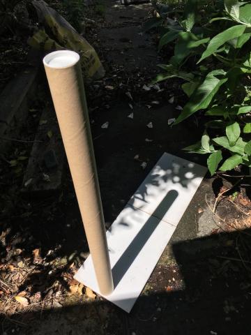
For the Solstick experiment, we collected lots of shadow stick measurements from people all over the UK.
Here we have one example of a measurement from near Liverpool and how we can estimate the circumference of the Earth using it.
We can estimate the size of the Earth by seeing how far away you are from somewhere nearer the equator where the Sun was directly overhead at the time the measurement was made. You can see how this works in detail here.
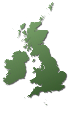
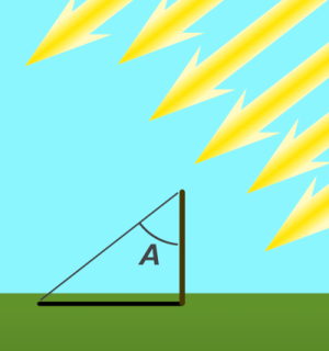
The map shows where one result was taken. A shadow of 56 cm from a stick 100cm tall made an angle of 29o to the stick (the angle A in the diagram).
This means that the distance between where the stick was and where the Sun was exactly overhead is 8% of the way around the globe.
We also know that if the scientist wanted to go to where the Sun was overhead, they would have to walk south for 3320 km.
That means that all the way around the world - the circumference - would be 41200 km and the diameter of the Earth would be 6700 km.
Since the actual circumference of the Earth is 40000 km the estimate of 41200 km is perhaps a bit large but really quite close.
If you want to see exactly how we worked this out, the full working is below.
Using lots of results
Whenever a scientist makes a measurement, there are always things that she cannot get exactly right, so the final number is never perfect. We call that small imperfection an error and all measurements have them.
Your measurement will also have an "error" - maybe the ground was not exactly flat, or the shadow was bit too fuzzy to see exactly where the end was and so on. You cannot do anything about this, so your answer will never be perfect, even if it is pretty good! However, if your number is a bit too large, somebody else might have an answer that is a bit too small. So, if we get lots of results and average them, all the errors will start to cancel out, and the final value will be much better than any single answer could possibly be.
This is why we want to collect as many measurements as possible. The final results show how averaging all the results gives a good answer.
- How we calculated the answer
With any scientific result it is important to know how the answer was worked out, so here is a step-by-step description of the working to get the estimate of the size of the Earth
In order to get an answer, we actually need not one shadow but two - both measured at the same time, and one much further south than the other like this:
Image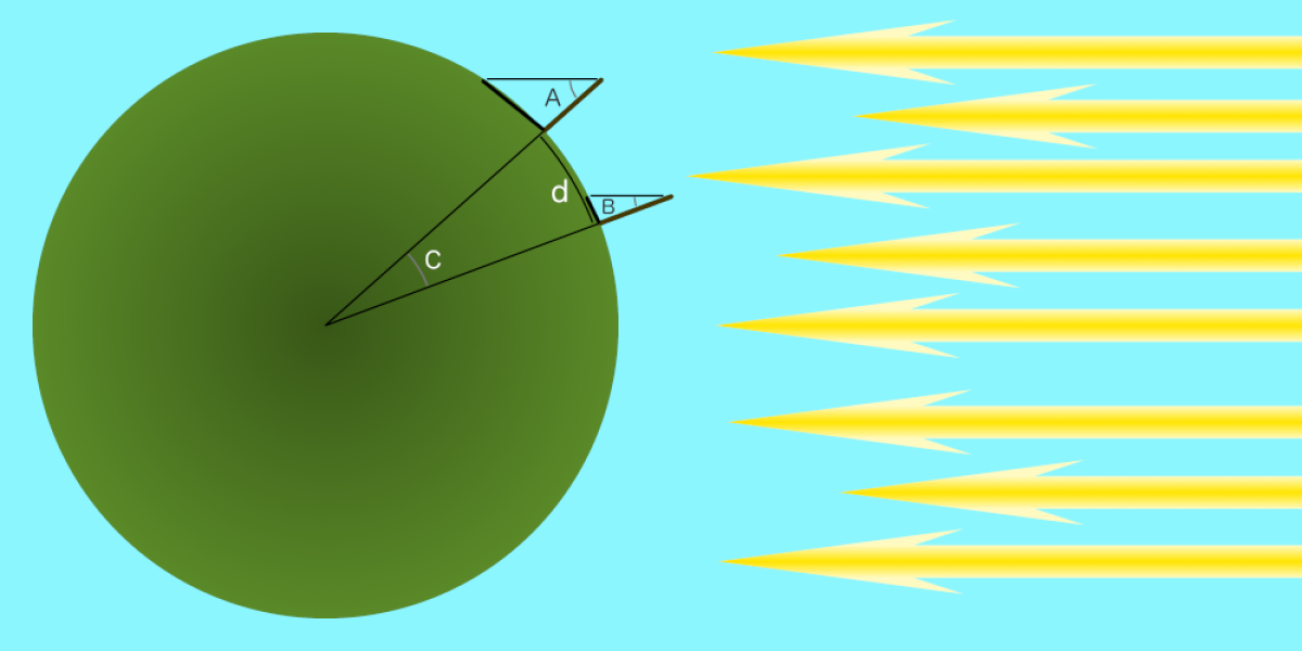 CreditThis work by TSO is licensed under All rights reserved
You cannot do this with just one shadow but, if you know what a shadow would be like at a suitable place and time, you do not need to actually measure it. Fortunately we know (as did ancient astronomers like Eratosthenes) that on the summer Solstice, the Sun will be exactly overhead in the middle of the day anywhere along the Tropic of Cancer (which is an imaginary line which runs round the world a bit north of the Equator).
So, as the measurement was taken near to the Solstice (which was the 21st June in 2023) and around the middle of the day (1PM British Summer Time), we can use an imaginary second stick due south of the UK on the Tropic of Cancer - right in the middle of the Algerian desert
In Eratothenes' day he had to rely on people keeping records of their travels over many weeks to work out the distance between places, but we are much luckier as explorers and cartographers have been making maps for hundreds of years, so we can just use them to find distances. For this experiment we are using two maps: a small scale map to find the distance from one place in the UK to the Tropic of Cancer (we chose the Greenwich Observatory in London) and a larger scale map of the UK to find out how far north or south the stick was from Greenwich. Using the two together, we can work out how far north it was from the Tropic.
- Step by Step
- Image
 CreditThis work by TSO is licensed under All rights reserved
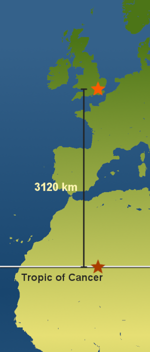
The distance from the Greenwich
Observatory to the Tropic of Cancer- Using a postcode and the large scale map of the UK we know that the stick was about 200 km north of the Greenwich Observatory.
- So the total distance from the Tropic of Cancer (d) is 3120 + 200 = 3320 km.
- Next we need to know the angle of the shadow A. Since we have a right-angled triangle, then:
tan(A) = shadow length / stick height
tan(A) = 56 / 100
So A = tan-1(56/100) = 29o. - Since the imaginary stick on the Tropic of Cancer has the Sun directly overhead, the angle B is zero, so angle C is the same as angle A (29o).
- 29o is 8% of 360o, so the distance between the stick and the Tropic of Cancer is 8% of the way around the globe.
- So the total circumference of the Earth from the measurement is:
Circumference = d x 360 / A
= 3320 x 360 / 29
= 41210 km. - Finally, rounding to the nearest 100km gives an estimate of the circumference of the Earth of 41200 km.